BOU AVENUE
Rawson Ridge
On 25 August 2012, I invited my good friends, Joanne Francis and Shelley Skelton, to join Kelly Bou and me for a hike up unofficially-named Rawson Ridge in Alberta's Peter Lougheed Provincial Park.  Following the trail description from Gillean Daffern's Kananaskis Country Trail Guide, we easily hiked to Rawson Lake in a little over an hour and continued around the south shore to the bottom of an obvious drainage emanating from Rawson Ridge.  Joanne, Kelly and I had previously visited Rawson Lake a couple of years earlier, but inclement weather on that occasion prevented us from venturing beyond the lake.  This time, the weather was perfect as we climbed the steep trail which initially runs alongside the drainage before veering up an avalanche chute.  Upon gaining the ridge crest, we took a short break to admire the breathtaking views of Upper Kananaskis Lake before venturing east toward the double summits of the ridge.  Having read Marko Stavric's trip report on ClubTread.com, I felt confident about climbing the cliff bands guarding the double summits.  I did not expect my companions to follow me, and indeed, they were content to relax at the base of the cliff bands and cheer me on.  The crux is actually fairly short (maybe 10 metres), but it is exposed and warrants Stavric's "difficult" rating.  According to my GPS, both summits are of equal height.  After tagging both summits, I down-climbed the crux and rejoined my companions, and together, we retraced our steps back to Rawson Lake and eventually the trailhead (round-trip time of 6 hours 45 minutes with a net elevation gain of 724 metres).  Before driving home, we helped shuttle a hiker back to his vehicle at the North Interlakes trailhead.  A subsequent quick stop to get ice cream from Fortress Junction capped off a thoroughly enjoyable outing for us all.
It's a good idea to get an early start on this trip to avoid the crowds. 
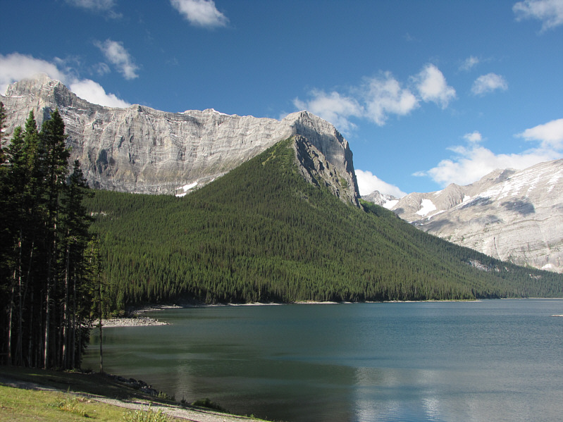
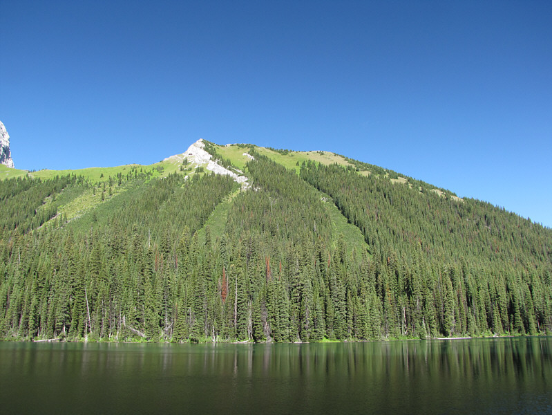
Rawson Ridge is the partially forested ridge at dead centre in this view from the trailhead.
What guy wouldn't like to be hiking with three lovely ladies? 
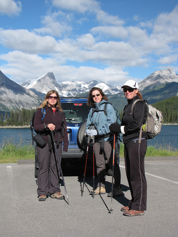
Kelly, Joanne and Shelley are ready to start hiking.
The scree slog might be easier with all the snow... 
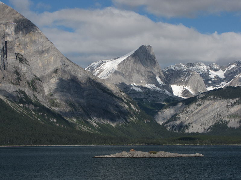
Mount Putnik is the distinctive peak across Upper Kananaskis Lake.
Didn't look so nice the last time I was here... 
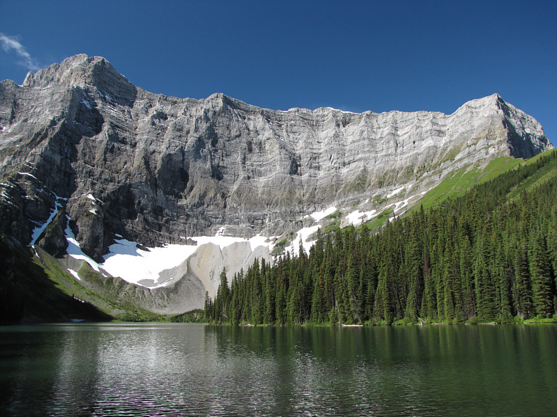
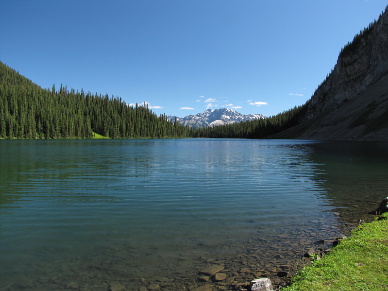
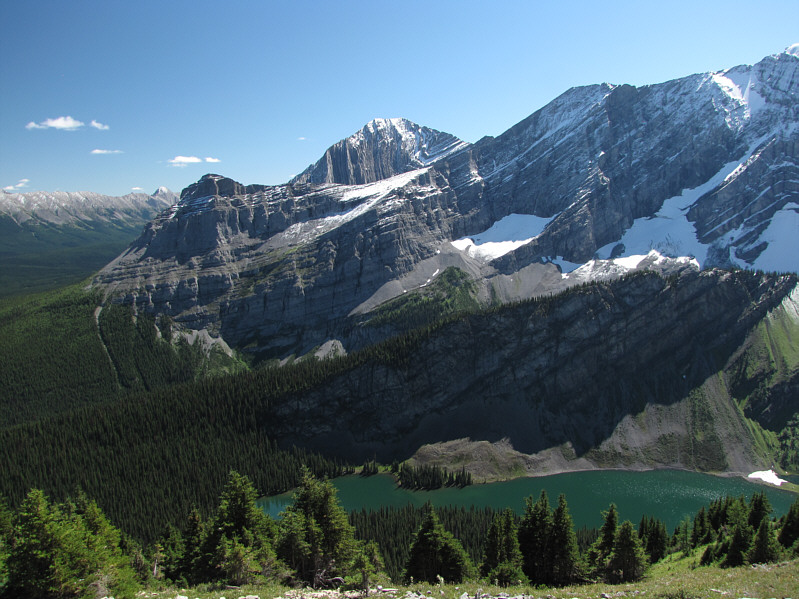
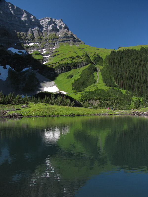
The east face of Mount Sarrail provides a stunning backdrop to Rawson Lake.
Wonder if anyone has tried a shortcut up those avalanche chutes... Rawson Ridge rises northwest of its namesake lake.
Good place for chit chat! A good trail winds around the south end of the lake.
Lots of people fishing today. 
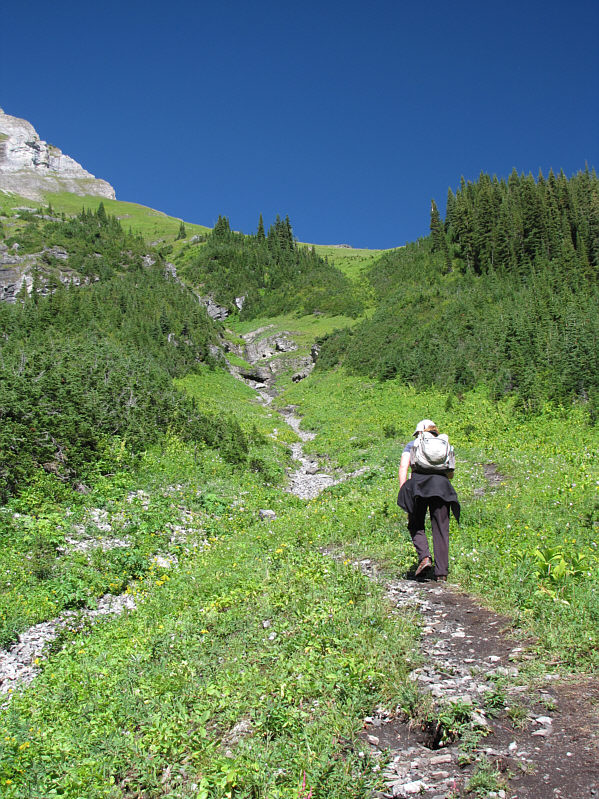
The route up Rawson Ridge follows the obvious drainage at far right.
A most unexpectedly pleasant view. Elpoca Mountain is visible to the northeast across Rawson Lake.
This is prime grizzly territory, so make lotsa noise! 
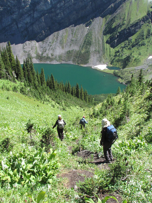
Kelly, Joanne and Shelley approach the access drainage.
This is a good place to catch your breath before the steep grunt ahead! Joanne points out the route to Shelley while Kelly forges ahead.
According to Kelly, it's better to stay left at an upcoming fork in the trail. Shelley hikes up the steep trail beside the drainage.
Real troopers these two are! 
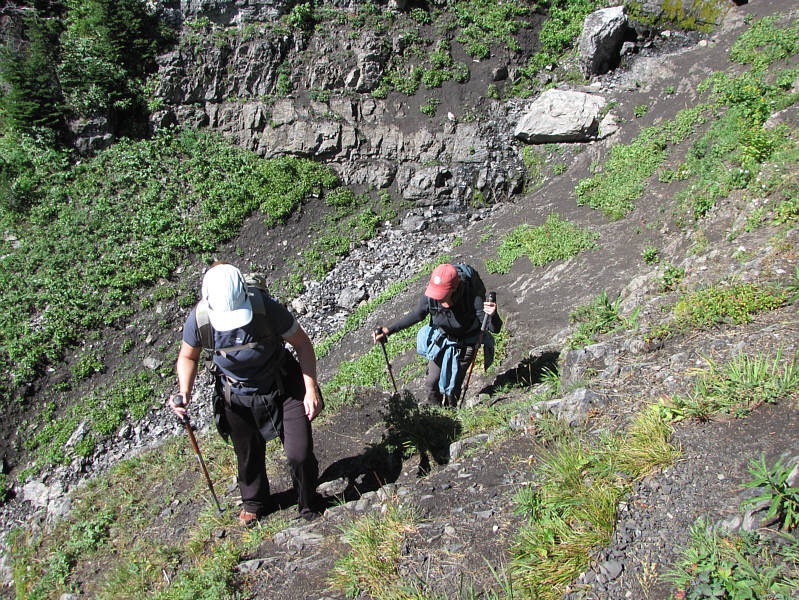
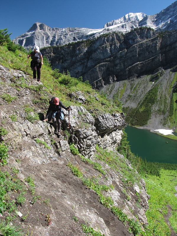
Shelley and Joanne scramble out of the drainage.
A very steep grind! 
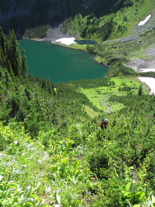
Kelly comes up an overgrown avalanche chute.
Most of the hard work is done at this point! Kelly emerges from the avalanche chute with Mounts Foch and Sarrail visible in the distance.
There's nothing sexier than the sweaty backs of women! 
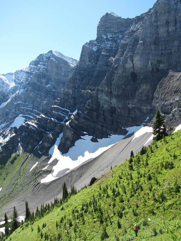
The ladies take a well-earned break after climbing up to the ridge.  Mount Indefatigable is visible across Upper Kananaskis Lake.
If you look closely, you should also be able to spot miniscule Mount Nomad (in front and left of Mount Warspite). 
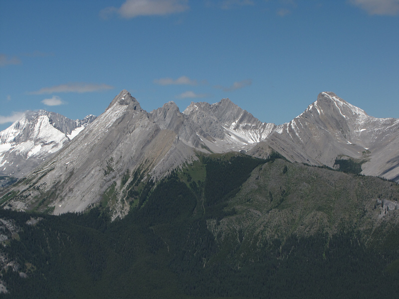
The two most prominent peaks to the northwest are Mount French (far left) and Mount Warspite (far right).
Looks a bit daunting! Joanne hikes toward the double high points of Rawson Ridge.


Lotsa fun!

Sonny climbs past the crux rockband.
Photo courtesy of Kelly Bou

The other summit always looks higher! This is the east summit as viewed from the west summit.
Amazing cliffs for such a lowly ridge! Sonny stands atop the east summit.
Photo courtesy of Kelly Bou


Great bang for your buck!

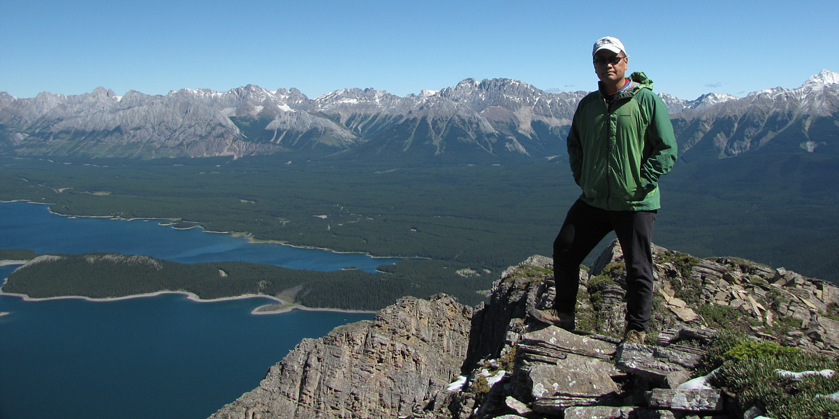
Sonny stands on the 2438-metre east summit of Rawson Ridge.


Can you spot the ladies relaxing on the ridge below? The massive wall at the northeast end of Mount Sarrail dominates the view to the west.
Looks like there's enough of a shoreline now to walk around. 
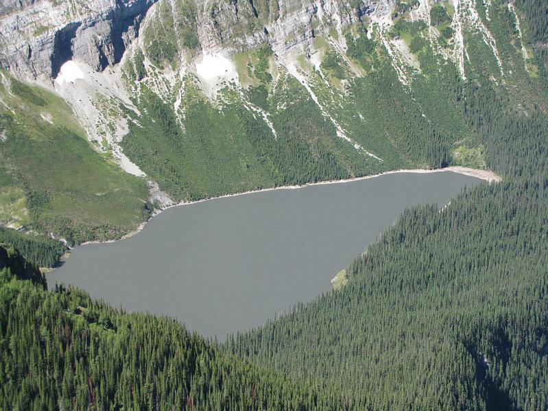
Hidden Lake looks remarkably dull.
That view is hard to beat! 
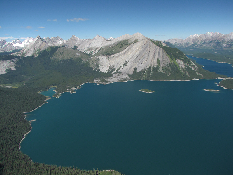
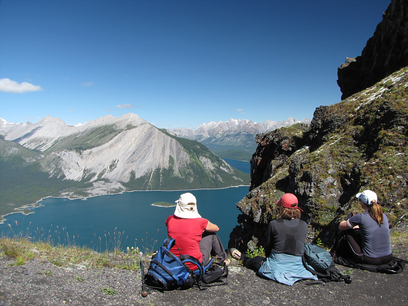
Upper Kananaskis Lake attracts all the attention to the north.  Lower Kananaskis Lake is visible at far right.
These mountains were dry as a bone only a few days earlier! To the east, Mount Rae is covered by new snow.
I wonder what the bushwhacking would be like if I were to drop straight down to the lake from here... Beyond Rawson Lake to the southeast are the Turret (left) and Mount Fox (centre).
Guess what? It looks higher! This is the west summit as viewed from the east summit.
It's great to hike with good friends. Sonny, Shelley, Joanne and Kelly pose for a group photo on the ridge crest.
Good thing I climbed Mount French last week before all the snow arrived! 
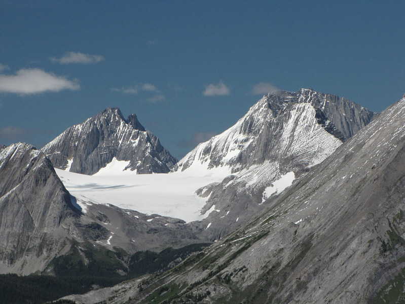
Here is a closer look at Mount Robertson (left), Mount French, and the Haig Glacier.
Lotsa people on their way up still. Shelley, Joanne and Kelly descend the avalanche chute.
Shouldn't be too long before these ladies are tackling Class 3 routes! Shelley follows Joanne down a short cliff band into the drainage.
The lakeshore was a virtual zoo of people on our way out. Joanne returns to Rawson Lake.
That green vegetation looks so innocuous from a distance... 
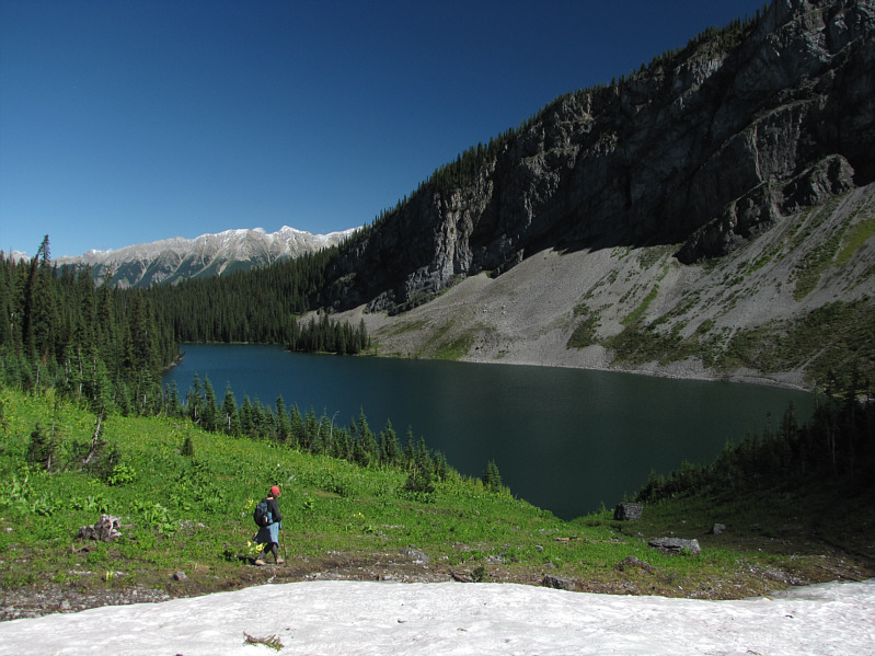
Here is another look at the access route to Rawson Ridge from a small tarn next to the lake.
Judging by the ice in the water, it's possible that this is a remnant glacier that persists year-round. 
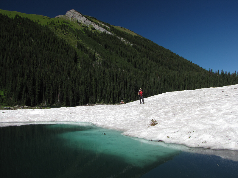
Kelly strolls onto a snow patch on the edge of the tarn.
I couldn't resist stopping for a photograph! The Sarrail Creek waterfall is popular spot not far from the trailhead.