BOU AVENUE
Mount Shark
I took a day off work on 7 July 2006 in order to participate in the Calgary Stampede Parade.  I was hoping that after the parade I would have plenty of daylight left to go out for a scramble.  As it turned out, the parade was a rather grueling ordeal and left me quite exhausted by the end (both my arms were numb from hauling and playing a euphonium for about 30 blocks).  I promptly went home and took a long nap.  When I woke up later in the afternoon, my fingers were still disturbingly numb, but I felt refreshed enough to drive out to Spray Valley Provincial Park (Kananaskis Country) and scramble up Mount Shark.  Starting from the trailhead at 5:54 PM, I quickly biked to Watridge Lake and hiked up to Karst Spring.  Climbing over the bench at trail's end, I tried to follow what beaten paths I could through the forest above.  I eventually hit a pretty good trail heading up and to the right (south).  I followed this trail until it began to level out at which point I simply headed uphill through open forest.  When I finally emerged from the trees, I noted with some grimness the steepness of the initial part of the ridge.  Furthermore, as I scrambled upward, a rather strong wind was blowing across the ridge and forced me to be doubly careful with my footing and handholds.  Once I got past this initial steep section, I settled into a generally enjoyable climb up the rest of the undulating ridge.  I made it to the summit by 9:20 PM and began heading back down at 9:38 PM.  Light was fading fast by the time I got back to the steep section, and as I feared, descending this proved to be slow and somewhat tricky.  Once I got off the rocks, I made a beeline for Watridge Lake and bushwhacked down the hillside mostly in the dark (I had forgotten to bring my headlamp).  Lower down, I homed in on the noise emanating from Karst Spring and eventually found myself a little below the source on the wrong side of the creek!  A short uphill bash and traverse got me back on the right side of the creek, and I quickly hiked out and retrieved my bike.  Thankfully, the wide road back to the trailhead is easy to bike even in the dark, and I made it to my car by 11:40 PM.
Wouldn't be surprised if it came from the leaky bathtub in my house. 
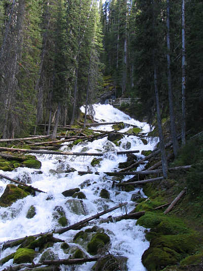
According to Gillean Daffern, the source of water for Karst Spring is a bit of a mystery.
That wind is also noticeable though you can't see it here. 
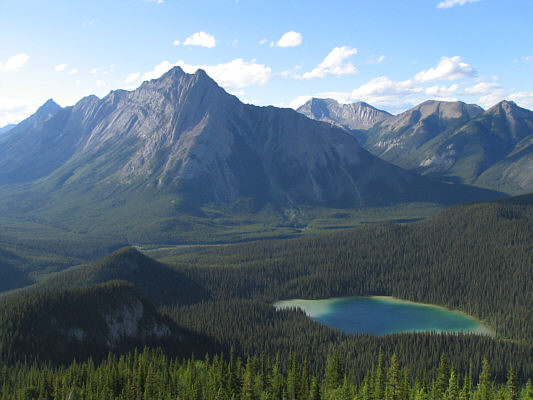
Cone Mountain (left) and Watridge Lake are immediately noticeable above tree line.
I stuck mostly to the ridge crest. 
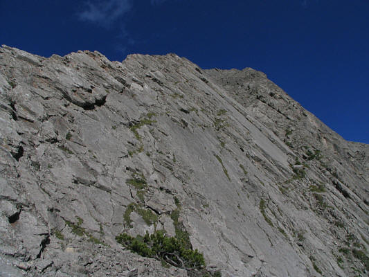
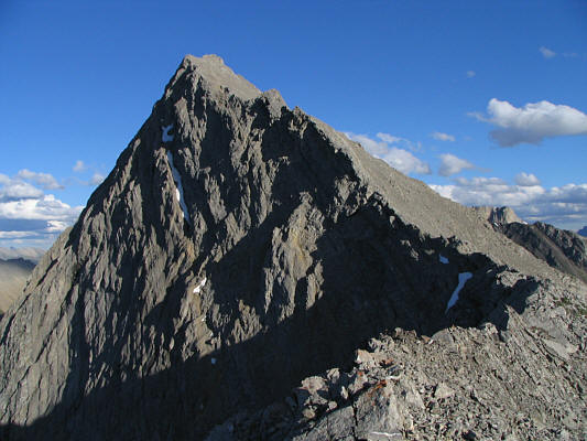
Here is part of the initial steep section of the ridge.
That reservoir may be man-made, but it still looks pretty nice. 
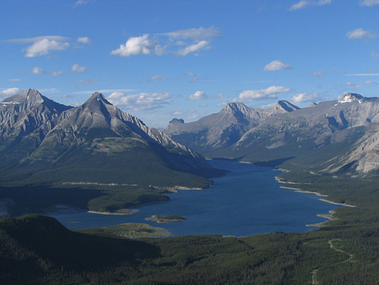
A plethora of peaks surround Spray Lake Reservoir including (L to R) Old Goat Mountain, Mount Nestor, Windtower, a couple of peaks of Mount Lougheed, and Mount Sparrowhawk.
Seems like everybody who has scrambled Mount Shark has taken this same shot more or less! Despite appearances, the rest of the ridge is simply good fun.
But the true summit is only 20 minutes away! 
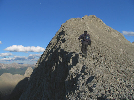
Sonny slowly climbs up to yet another false summit.
Yeah, we're almost there! 
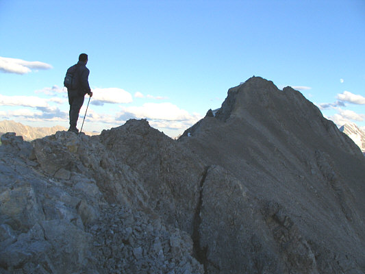
Finally, the true summit comes into view.
I wear my sunglasses at night... 
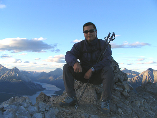
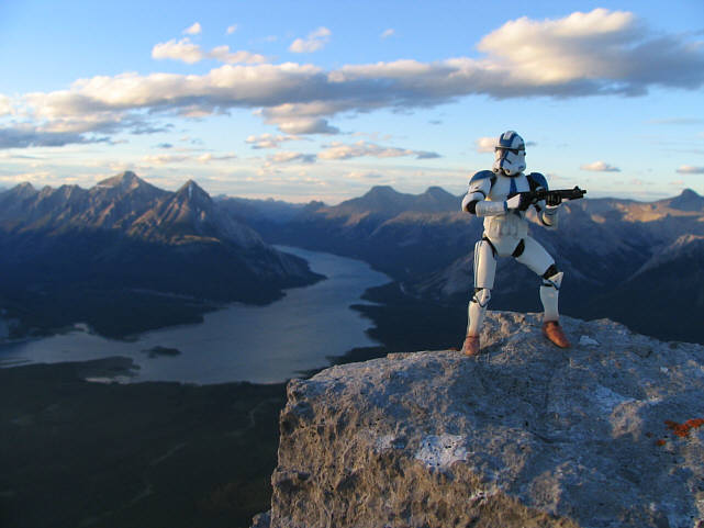
Sonny sits in front of the cairn on the 2786-metre summit of Mount Shark.
Need it.  Need it.  Got it.  Got it. 
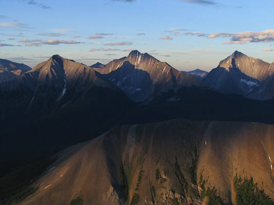
The setting sun casts some interesting shadows on the peaks to the east.  L to R are Mount Engadine, The Tower, and Mount Galatea.  In the foreground is Tent Ridge.
Hey, look who was here earlier today!! 
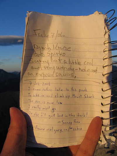
This is what Sonny wrote in the summit register.
Hard to believe that the alternate descent route on Mount Smuts comes down this side! 
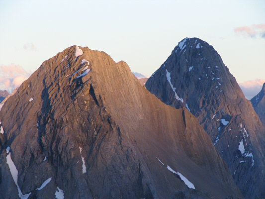
The last rays of sunlight fall on Mount Smuts (left) and Mount Birdwood.
I don't think the moonlight was very helpful on my descent through the trees. 
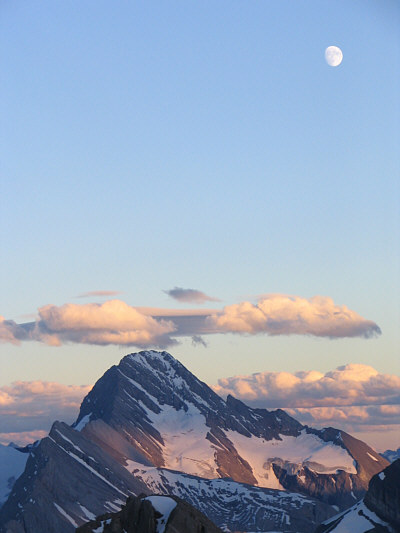
A waxing gibbous moon rises high above Mount Sir Douglas.