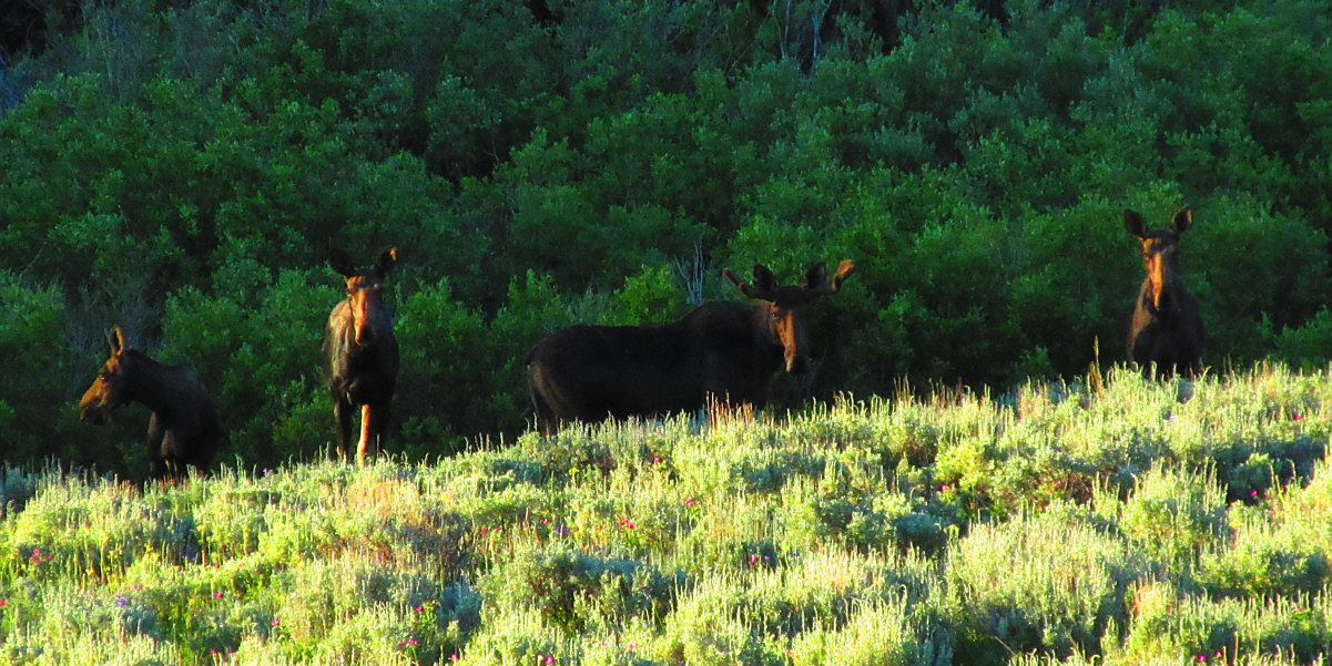
Early in the morning, four moose are startled by a car stopping on the side of US Highway 14 Alternate somewhere near Burgess Junction.
Photo courtesy of Zosia Zgolak
First up was Sykes Mountain Trail which begins at the Crooked Creek ranger station located along State Highway 37 about 15 kilometres north of the junction with US Highway 14/14A. Leaving my car at the ranger station, we walked across the highway and found the trailhead which is right beside a big sign board for Horseshoe Bend. The terrain here is very much like a desert, and it felt reminiscent of the hiking in southern Nevada or Arizona. One odd difference though was the surprising presence of mosquitoes in this supposedly arid landscape. While not as prolific as what we encountered recently in Cloud Peak Wilderness, the mosquitoes here proved to be just as persistent and still highly annoying.
Zosia and I skirted around the north end of
an outlying ridge before heading south up a draw to gain the northwest
ridge of Sykes Mountain. Although the trail is initially easy to
follow, it is less defined higher up the ridge. Fortunately, trail
markers are plentiful, and the terrain itself is easy to negotiate even
when off-route. The official trail ends at an unexpectedly scenic
overlook with a commanding view of Bighorn Lake to the east. From
there, it is possible to wander either to the actual summit of Sykes
Mountain about 1.7 kilometres further to the southeast or to an even
higher point known as Crooked summit about a kilometre to the southwest.
Unfortunately, the rising heat of the day was becoming unbearable, and
after taking a few photographs from the overlook, we beat a hasty retreat
back to the trailhead and ranger station.
Photo courtesy of Zosia Zgolak
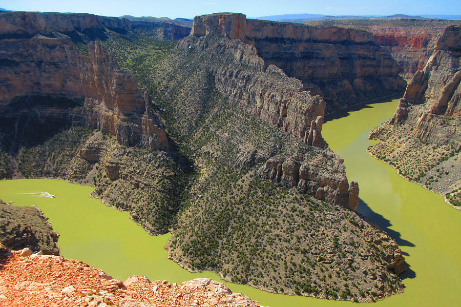
Sykes Mountain Trail ends at an overlook with this view
of Bighorn Lake. The marina at Horseshoe Bend is also visible at
left. Photo courtesy of
Zosia Zgolak
Photo courtesy of Zosia Zgolak
Photo courtesy of Zosia Zgolak
Photo courtesy of Zosia Zgolak
Photo courtesy of Zosia Zgolak
Photo courtesy of Zosia Zgolak
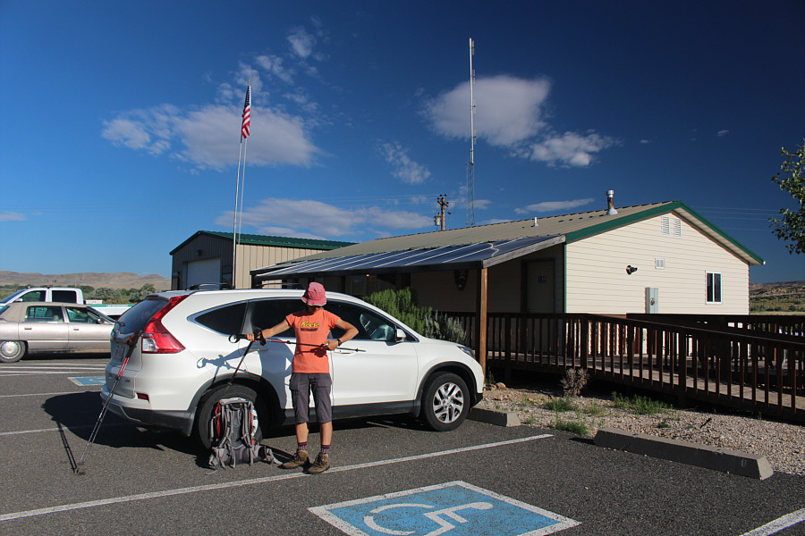
Zosia gets ready to hike from Crooked Creek ranger station (water and
public washroom available).
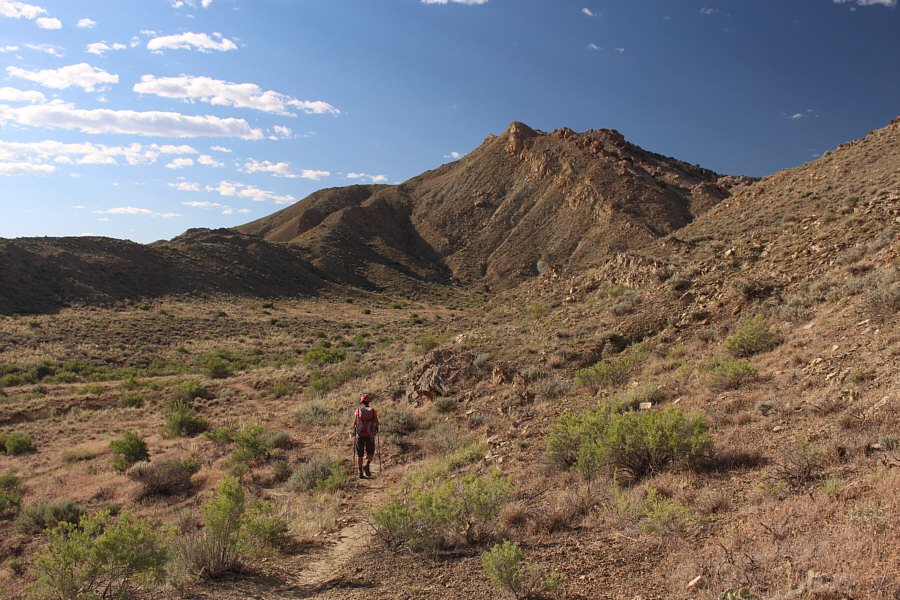
Zosia follows Sykes Mountain Trail toward the northwest end of its
namesake land feature.
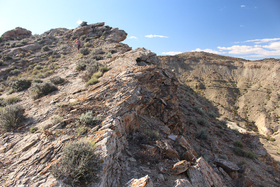
The signed trail is less defined higher up the northwest ridge.
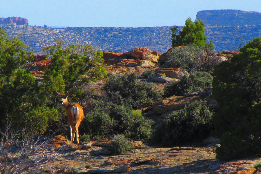
A mule deer looks back warily at some bipedal creatures passing nearby.
Near the end of Sykes Mountain Trail, Zosia tests the looseness of a huge
boulder that seems poised to tumble down the cliff.

Given the hot weather, Zosia and I decided to forego the rest
of the hikes we had planned, and instead, we essentially toured the rest
of the southern half of the NRA by car. This included brief stops
at Devils Canyon Overlook, Two Eagles Interpretive Trail and Barry's
Landing--all located on the MT side of the state border. Returning
to WY, we stopped at Horseshoe Bend for an extended lunch break before
heading to the NRA's visitor centre in nearby Lovell, WY. At our
request, the park staff played an interpretive movie for us, and we took
advantage of the opportunity to have a wonderful nap in the dark and
air-conditioned theatre. Once we were suitably refreshed, we
departed the visitor centre and ultimately left WY for good.

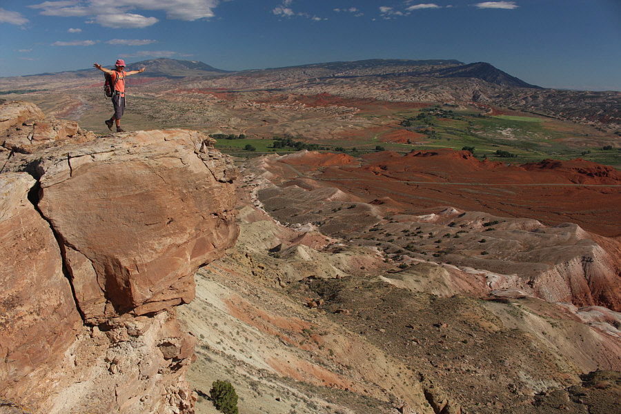
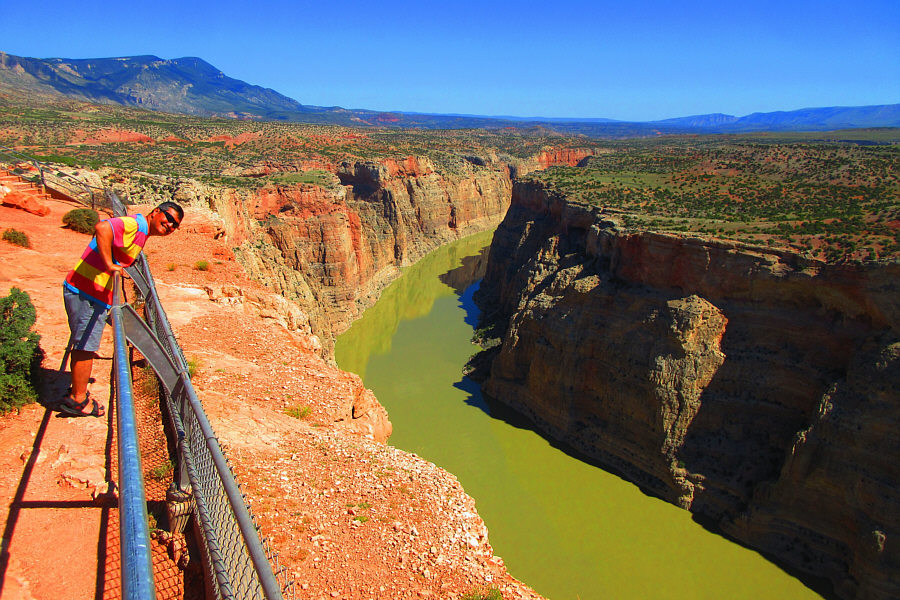
Sonny and Zosia pose at the overlook in front of Bighorn Lake.
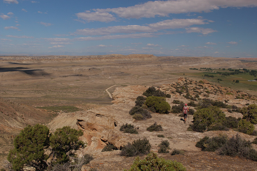
With the heat of the day becoming unbearable, Zosia descends the trail
with some urgency.
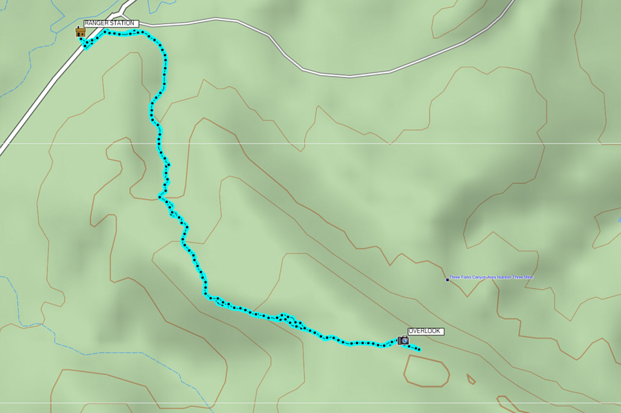
Total
Distance: 4.7 kilometres
Round-Trip Time: 1 hour 59 minutes
Net Elevation Gain: 169 metres

Behind this roadside interpretive display is
a comprehensive view of Sykes Mountain. The display talks about
wild horses that road the area.
On the MT side of the state border,
Devil Canyon Overlook provides probably the best views of Bighorn Canyon.
Note the motor boat on Bighorn River below.
Here is the view to the north from the other side of Devil Canyon
Overlook. At far left are the Pryor Mountains.

All around Two Eagles Interpretive Trail are rings of stones that were
once used to hold down the edges of teepees while nomadic Native American
tribes were camping in the area. Once the tribes moved on, the
stones were left behind in their ring formations.
In the southern section of Bighorn Canyon NRA, the paved access road ends
at a boat launch called Barry's Landing.

A lone wild horse grazes on a ridge next to the road.

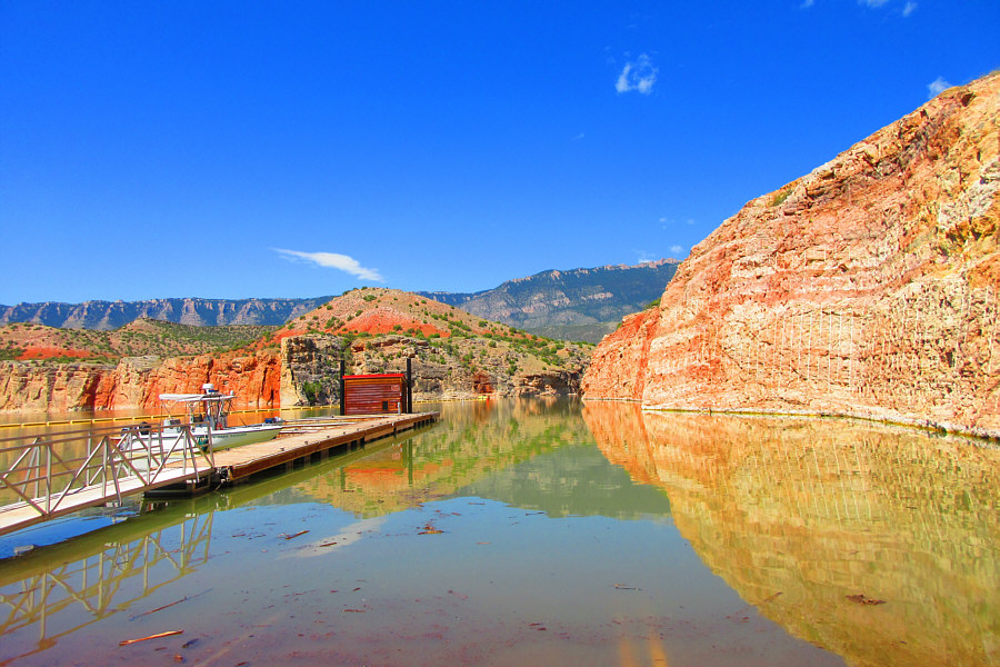
Returning to WY, Sonny enjoys lunch under a picnic shelter near the
marina at Horseshoe Bend. Sykes Mountain is visible across Bighorn
Lake.

At the NRA's visitor centre in Lovell, Zosia dons a bear skin before
hibernating in the air-conditioned theatre.