 |
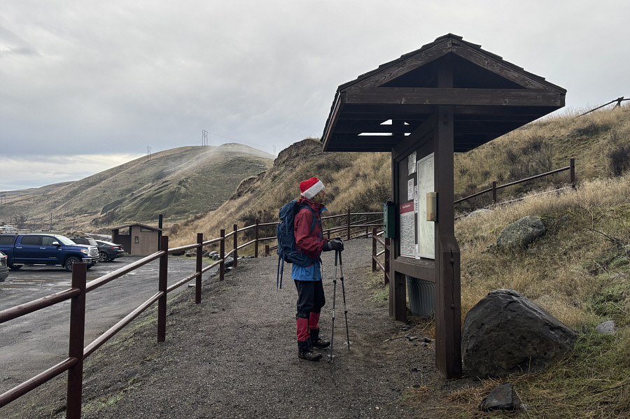
"Warren's Ridge" is visible at distant left as Zosia reads some information at the trailhead. |
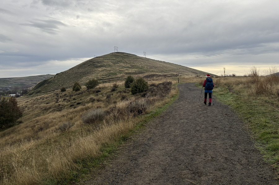 |
Zosia marches along "Easy Street" with the west end of Warren's Ridge in view. |
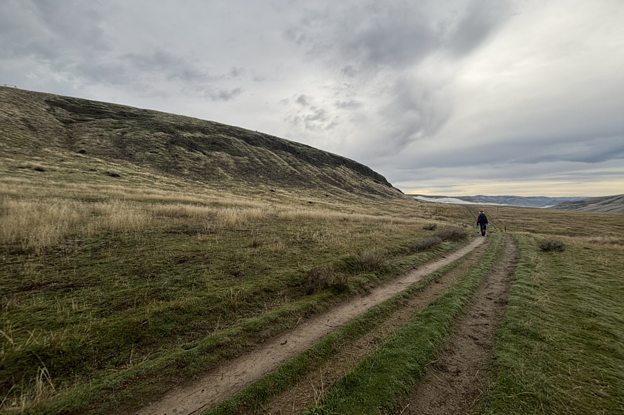 |
Zosia passes the steep southern flank of Warren's Ridge. |
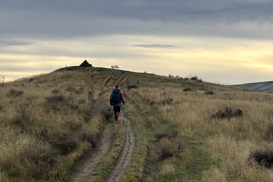 |
Zosia approaches the top of "Charlie's Peak". |
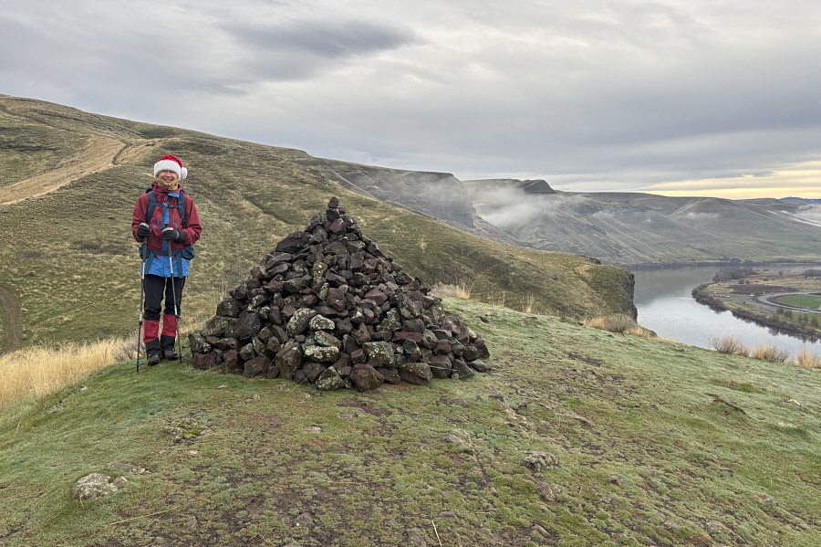 |
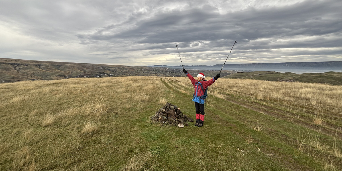
Zosia stands atop of Charlie's Peak (307 metres) with Snake River visible in the valley at right. |
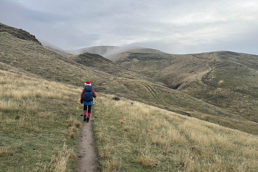 |
Zosia heads for the coulee to ascend the east end of Warren's Ridge. |
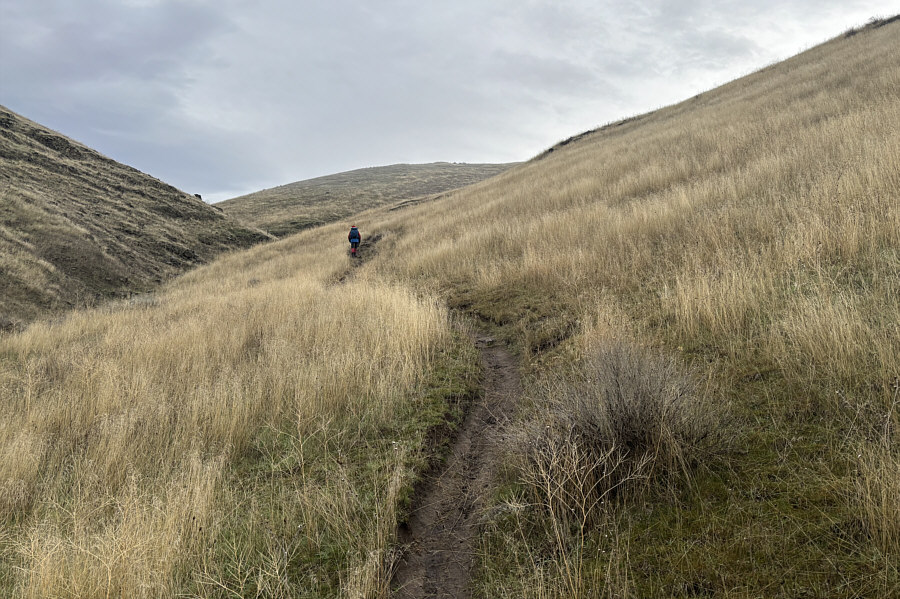 |
This trail in the coulee is called "Kip's Cutoff". |
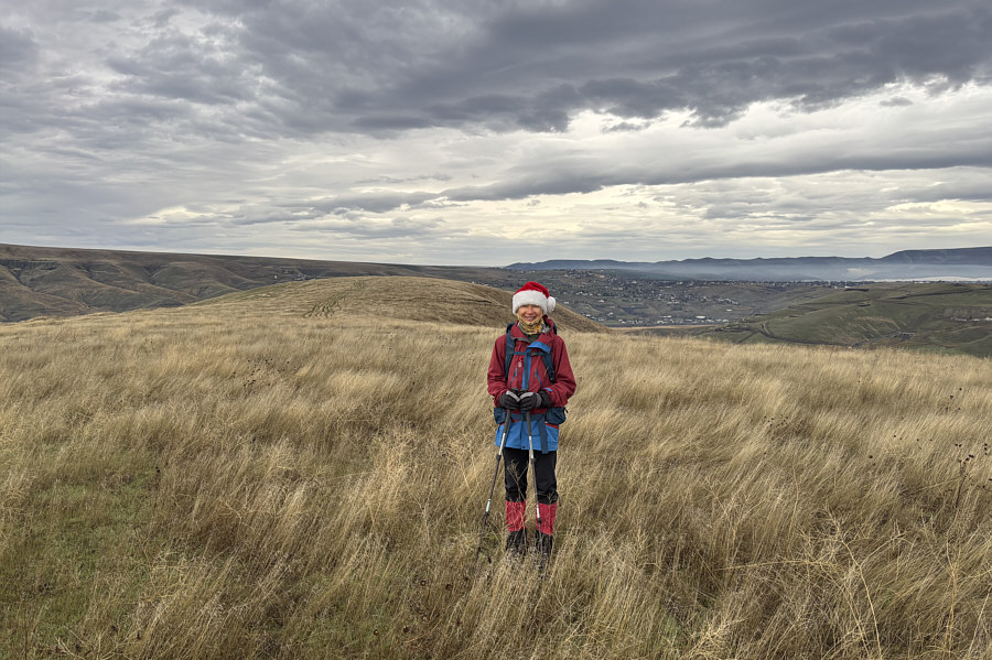 |
Zosia stands on the eastern high point (422 metres) of Warren's Ridge. The western high point is visible behind her. |
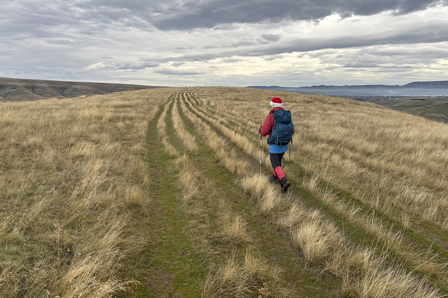 |
Zosia follows multiple parallel tracks along the crest of Warren's Ridge. |
Zosia stands on the western high point (422 metres) of Warren's Ridge.
 |
As Zosia walks back to the trailhead, the striking formation known as Swallow Rock can be seen in the distance through the gap. |
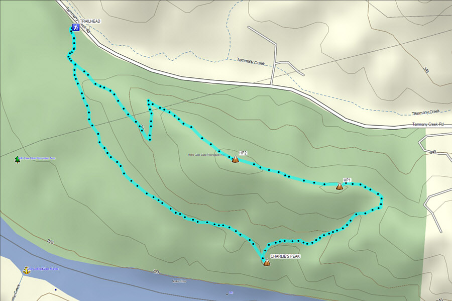 |
Total Distance: 5.4 kilometres Round-Trip Time: 1 hour 54 minutes Cumulative Elevation Gain: 146 metres |
From the parking area, Zosia and I crossed a decommissioned section of the old Highway 95 and then passed through a v-gate to reach the start of the trail. The moderately steep trail initially felt mildly exposed because of a lack of vegetation, but as we climbed higher, thorny bushes began to encroach on the trail. At one point, we even had to duck down to get through the increasingly overgrown trail. Climbing the last few metres to the cave entrance was surprisingly challenging even with the aid of a fixed rope. The trail is very steep here and partly eroded from all the moisture trickling down from the cave. Worse, the moisture made the footing dangerously slick, and I am doubtful that we would have continued had the rope not been there. With water dripping everywhere, most of the cave floor was flooded, but we were still able to awkwardly sneak into the drier back part of the cave where we startled several pigeons roosting there.
When we had our fill of stepping in bird poop, Zosia and I made our way back out the cave. The descent of the fixed-rope section was just as nerve-racking as the ascent, but we both thankfully made it down without a slip. The remaining hike out was uneventful, and we were soon back in our car and driving south to our next vacation destination.
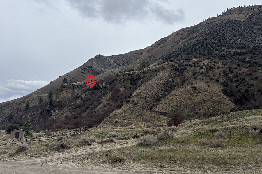 |
In this view from the parking area, the approximate location of Lucile Cave is indicated. |
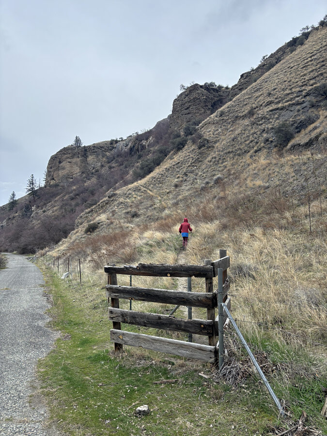 |
After crossing the decommissioned old Highway 95 and passing through a v-gate, Zosia starts climbing up the trail to Lucile Cave. |
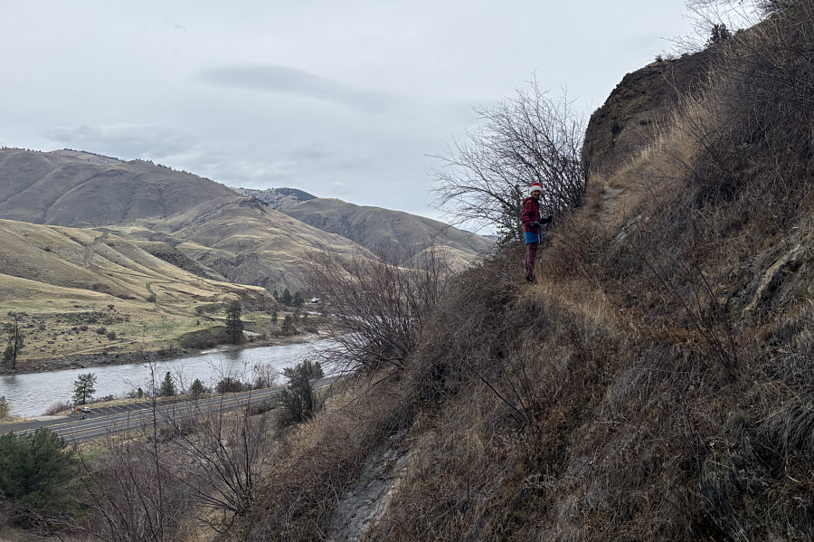 |
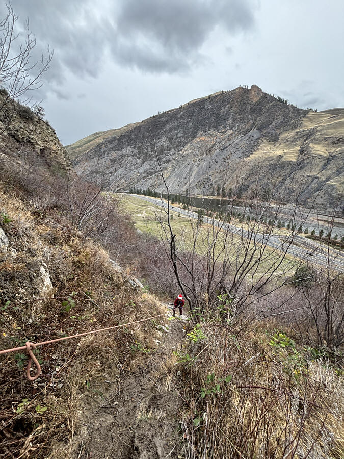
Salmon River and Highway 95 are visible as Zosia climbs higher up the trail. |
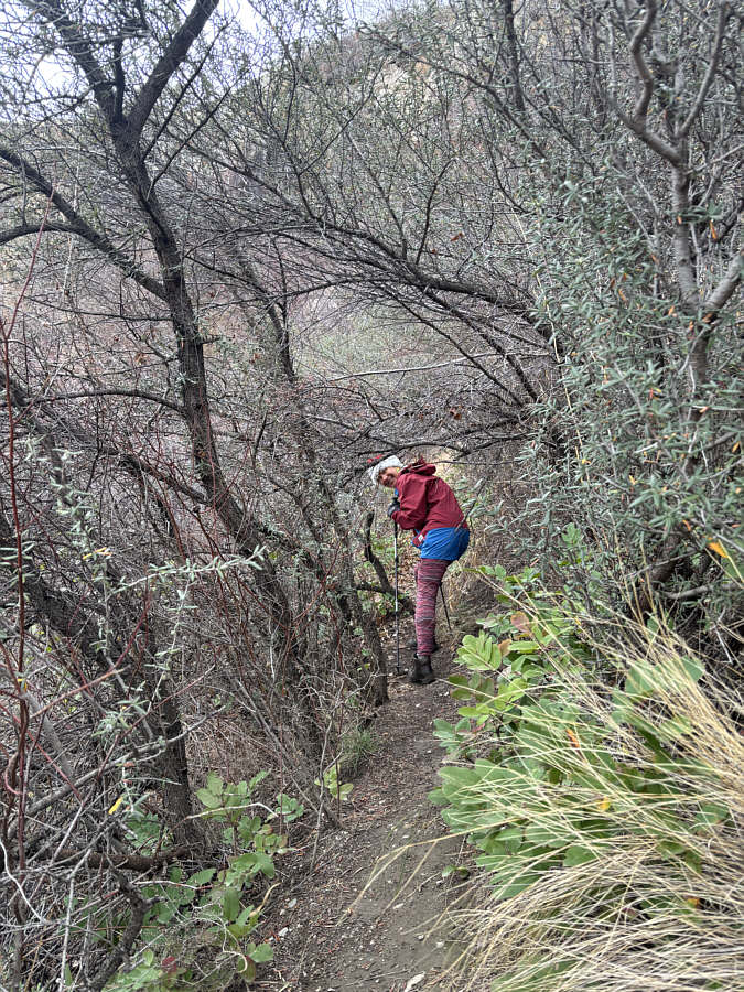 |
Parts of the trail are overgrown with thorny bushes. |
 |
A fixed rope aids the final steep ascent to the cave entrance. |
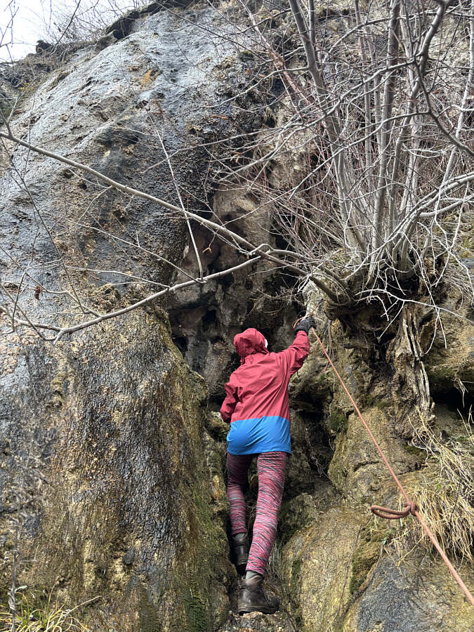 |
Zosia reaches the top of the fixed rope at the entrance of the cave. |
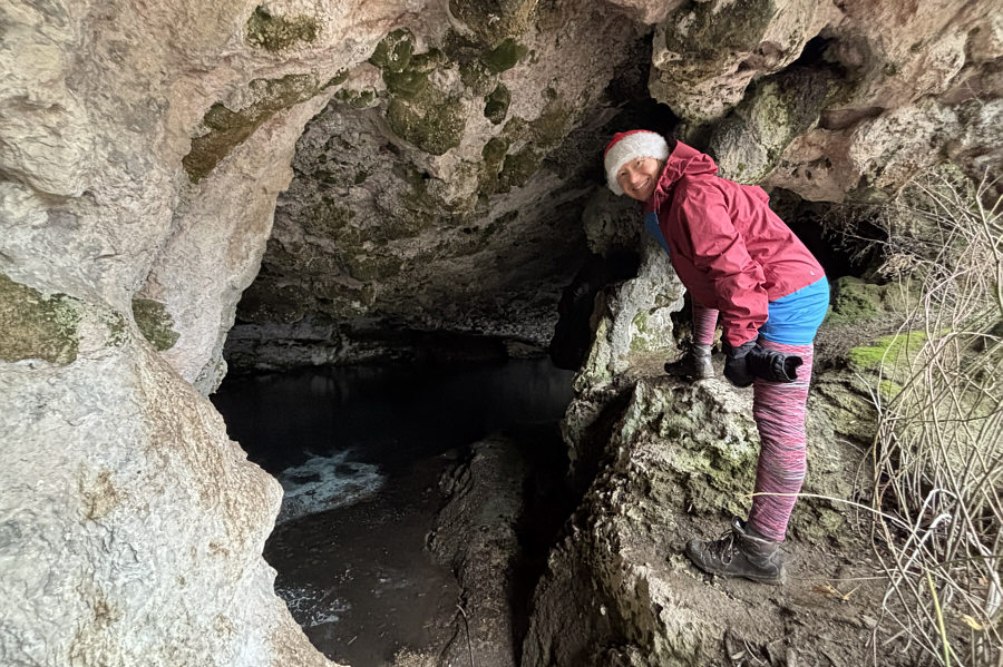 |
At the cave entrance, Zosia sees that much of floor of Lucile Cave is flooded. |
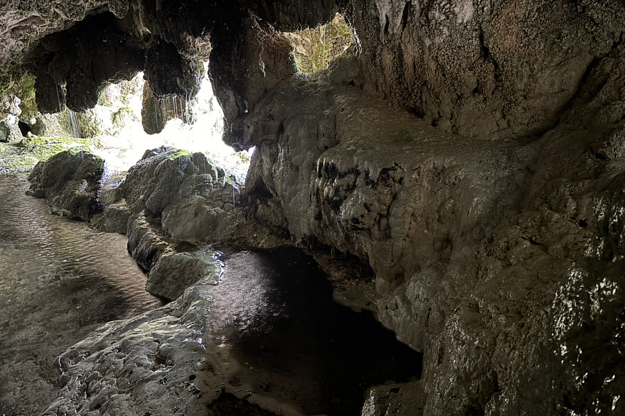 |
Speleothems are evident inside Lucile Cave. |
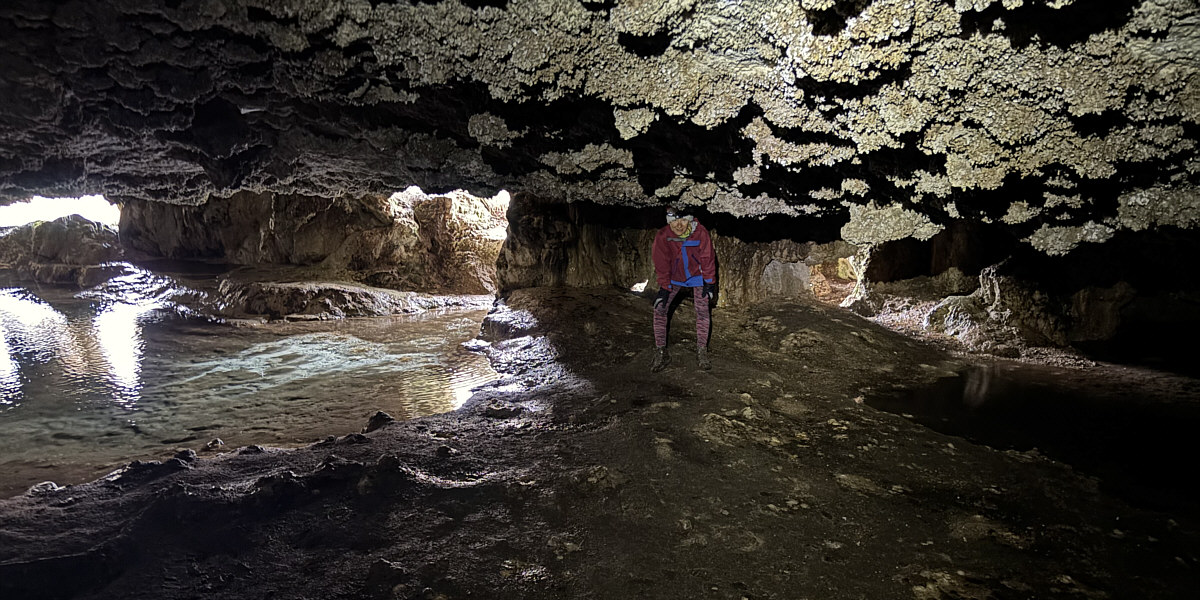
Here is a more comprehensive view of the interior of Lucile Cave.
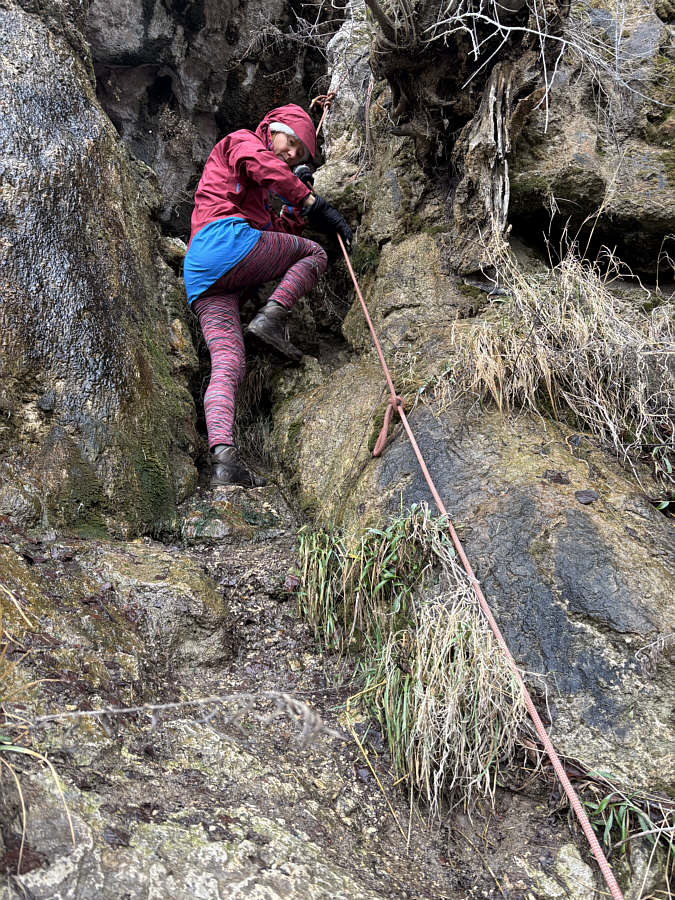 |
Zosia carefully descends from the cave entrance with the help of the fixed rope. |
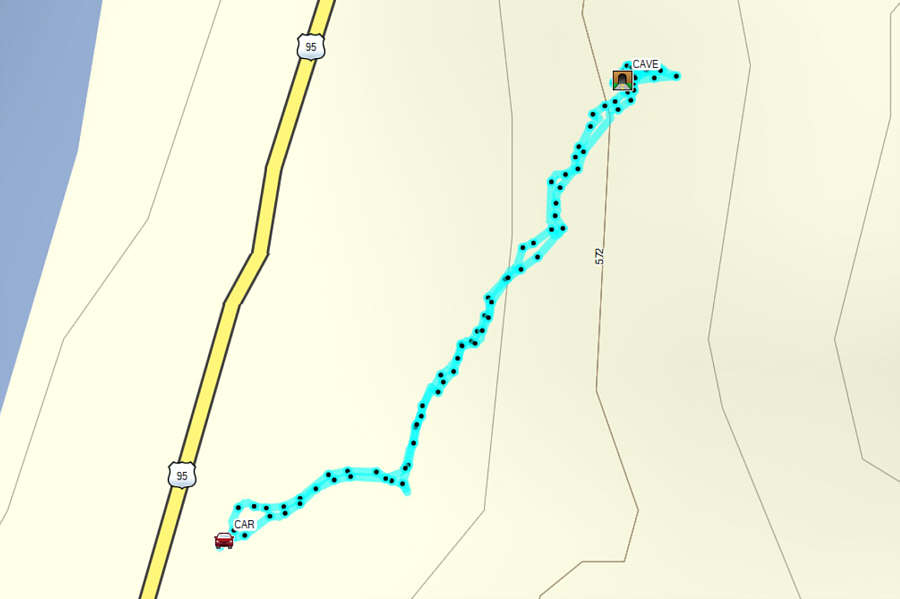 |
Total Distance: 1.1 kilometres Round-Trip Time: 50 minutes Cumulative Elevation Gain: 68 metres |