BOU AVENUE
Rabbit Mountain, Hooper Springs, Soda Springs Geyser And Niter Ice Cave

With a rather lousy weather forecast to start the New Year, Zosia Zgolak and I traveled to Soda Springs, Idaho on 1 January 2026 to do some relatively easy sight-seeing.  Soda Springs is renowned for the numerous springs of naturally carbonated water found in and around the city, and it is also home to the celebrated Soda Springs Geyser which erupts every hour on the hour.  Upon our arrival in the city in the morning, the weather had not yet deteriorated, and we could not resist climbing one of the local hills officially named Rabbit Mountain.

Starting from a trailhead (42.66492, -111.57442) at the east end of Kelly Park, Zosia and I walked eastward along a pathway which cuts through a disc golf course/cross-country ski trail network to an obvious water storage tank.  From there, we briefly headed northward along a grassy jeep track before veering right onto a fainter jeep track climbing up the west slope of Rabbit Mountain.  The jeep track was easy to ascend and led us to several telecommunications structures at the top.  Because the top of Rabbit Mountain is so flat, the location of the true summit is a bit hard to pinpoint (no obvious cairns), and after wandering around for a bit, we ultimately selected a spot that looked the highest to us.  With little reason to linger after tagging the summit, we promptly retraced our steps along the jeep track and descended back to the trailhead without any problems.
Almost enough snow to ski...almost... 
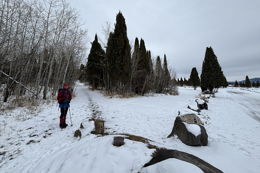
Zosia begins her hike up Rabbit Mountain from this trailhead at the east end of Kelly Park.
Surprisingly, there's actually a disc golf course here! 
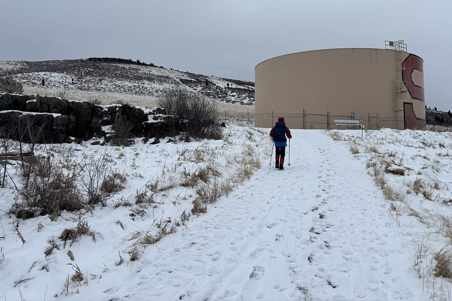
Rabbit Mountain is visible at left as Zosia approaches a water storage tank.
A bit more challenging to hike with the snow. 
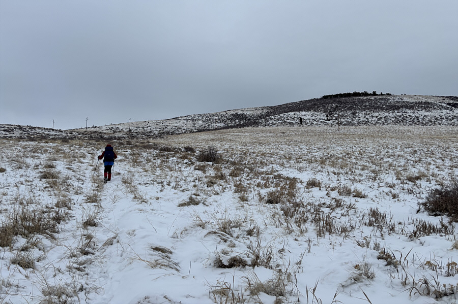
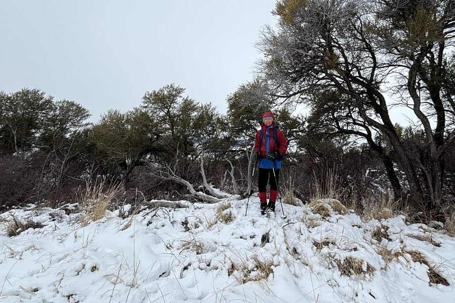
Zosia follows a jeep track that leads to the top of Rabbit Mountain.
Where's the summit?

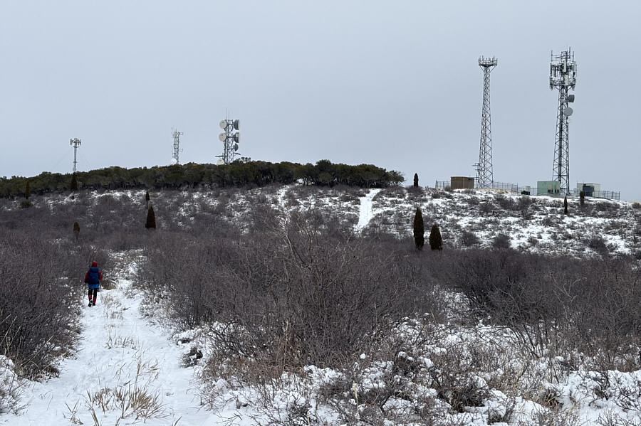
Several antennas are scattered across the top of Rabbit Mountain.

As good as any other spot, I guess! Zosia stands on the apparent summit of Rabbit Mountain (2029 metres).
Maybe we'll come back and explore once they start naming a few of the ridges! 
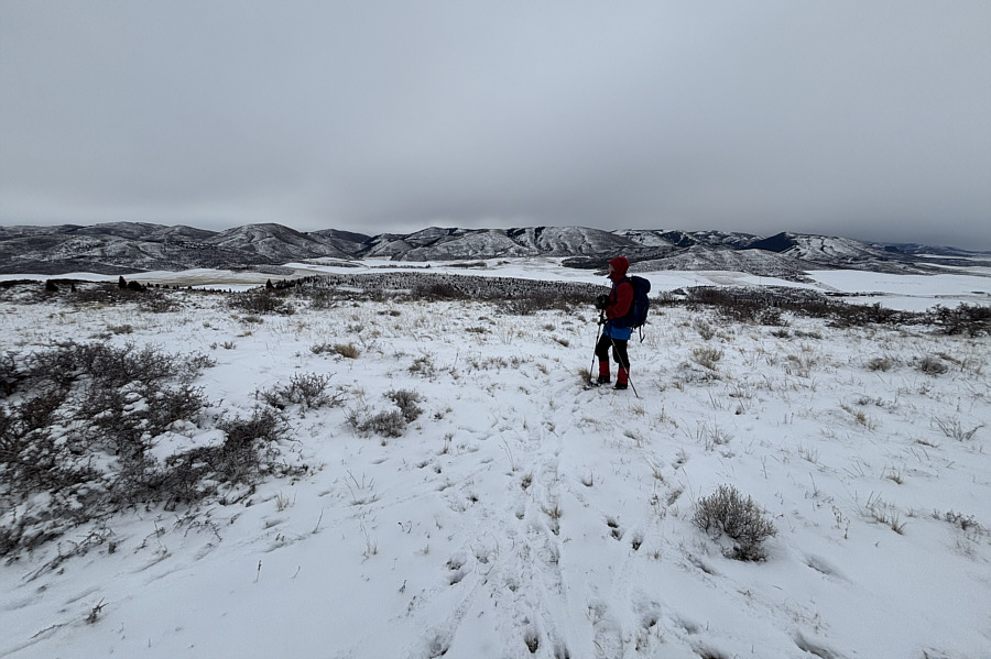
Zosia looks eastward toward mostly nameless ridges in the Aspen Range.
The reservoir probably stands out more in the summer! 
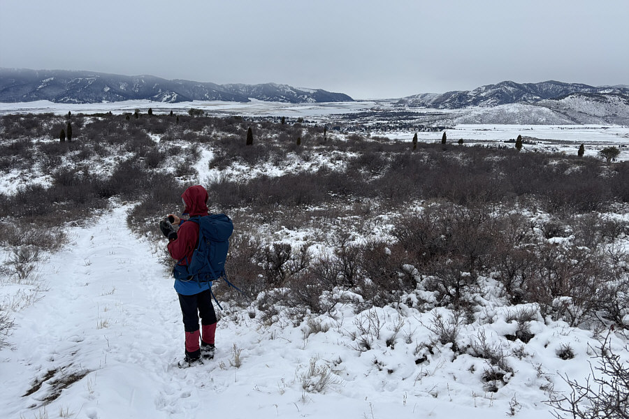
Alexander Reservoir is visible at distant centre as Zosia begins her descent.
 

There is some controversy regarding the phosphate plant.

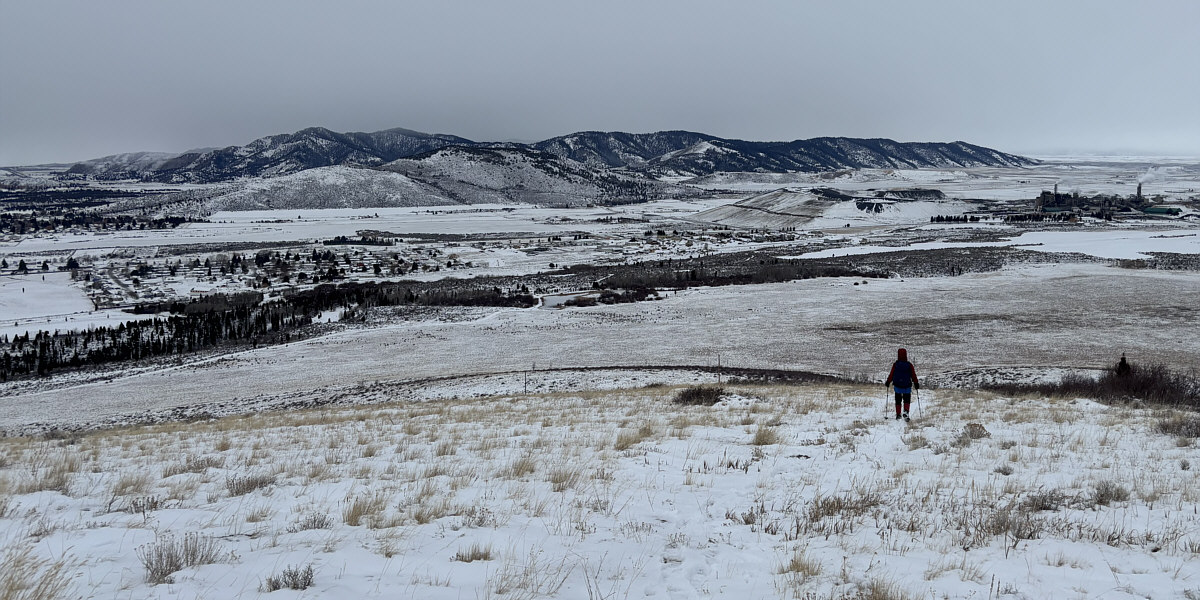
At far right in this view from Rabbit Mountain's west slope is a phosphate processing plant owned by Bayer.


First summit of the New Year! 
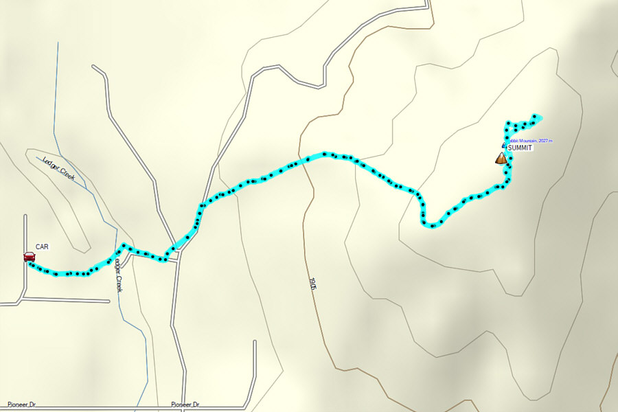
Total Distance:  4.7 kilometres
Round-Trip Time:  1 hour 47 minutes
Cumulative Elevation Gain:  227 metres

GPX Data

Upon completion of our hike up Rabbit Mountain, Zosia and I drove to Hooper Springs Park located along Government Dam Road on the northern outskirts of the city.  With an elaborate stone pavilion built right over Hooper Spring, this is probably the best-developed of the handful of springs that can be found throughout the area.  Drawing water from the spring is free, and Zosia brought along her thermos so that we could try tasting the naturally carbonated water.  The water from Hooper Spring had a distinct metallic taste--apparently due to high iron content--and most disappointingly, the carbonation, though present, was weak like drinking a flat soda that has been left opened for too long.  It was certainly not as good as the carbonated mineral water we tasted--for a fee--in Kudowa-Zdrój, Poland a few years ago, but I guess you get what you pay for!
Did you remember to bring a cup? 
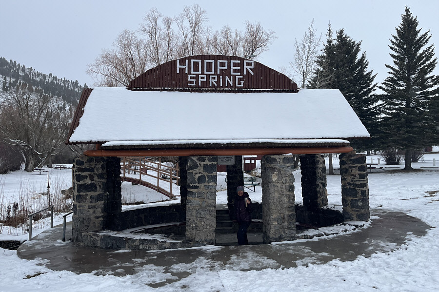
Located a short distance north of the city of Soda Springs is Hooper Spring from which emanates naturally carbonated water.
Being open to the public, I wonder if anyone has ever peed in here... 
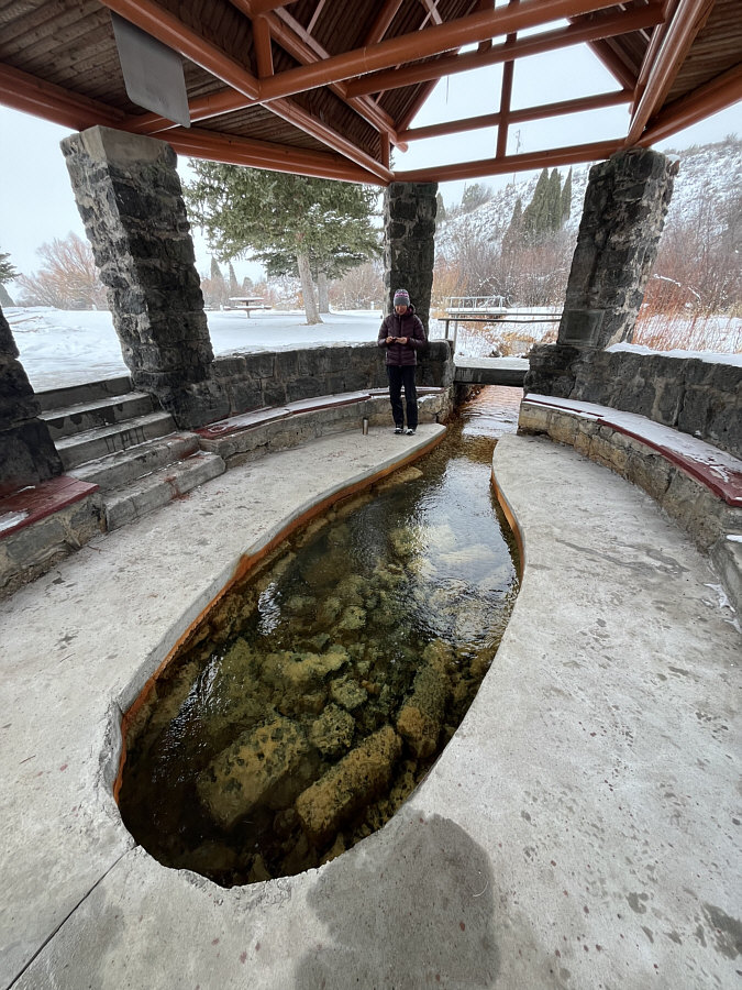
Here is a closer look at Hooper Spring.
Leaving Hooper Springs Park, Zosia and I next drove into downtown to see the Soda Springs Geyser located just south of the train tracks between Main Street and the Fairview Cemetery.  The geyser was accidentally created in 1937 during a drilling operation to find water for a hot springs pool.  The geyser was ultimately capped with its eruptions regulated making it the world's only captive geyser.  We arrived a little early before the top of the hour and were pleasantly surprised to find the nearby unmanned but heated interpretive centre building open (with convenient washrooms).  At the top of the hour, we went back outside, and despite being slightly late, the geyser erupted as expected.  The eruption lasted well over ten minutes and was well worth the price of admission (free!).
The water is warm but not scalding. 
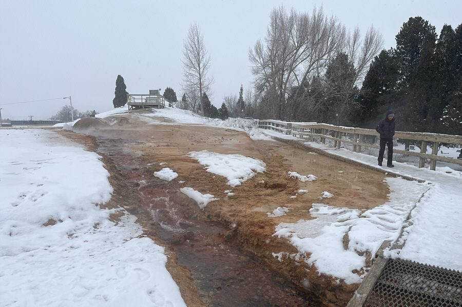
The city of Soda Springs is renowned for a controlled geyser that erupts at the top of every hour.  Zosia waits in anticipation for the next eruption.
IMO, better than overhyped Old Faithful with its annoying crowds and long, drawn-out waits! 
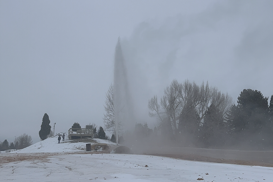
The geyser erupts at the top of the hour and lasts for well over ten minutes.  Click here to see a video of the geyser eruption.
Once the Soda Springs Geyser show finished, Zosia and I hit the highway to drive to our last attraction of the day--Niter Ice Cave.

From US Highway 30, turn south onto Idaho Highway 34 about 44.1 kilometres east of the intersection with I-15 or 10.7 kilometres west of the intersection with Main Street in Soda Springs.  Drive 12.9 kilometres through the town of Grace and turn left at Ice Cave Road (2WD gravel).  Drive 350 metres and turn left into a pullout beside an interpretive sign.  Park here.

Yet another of the seemingly countless lava tubes in Idaho, Niter Ice Cave was used by early settlers as sort of a natural refrigerator to store perishable food items such as milk and cream.  For Zosia and me, the cave was an ideal place to go for a short walk as light rain began falling steadily over the region.  Similar to other caves outside of established parks and especially those with easy access, Niter Ice Cave has sadly suffered its fair share of abuse in the form of graffiti and trash.  For the life of me, I still cannot wrap my head around the idea of purchasing and carrying a can of spray paint for any outdoor adventure!

In any case, Zosia and I walked as far as we could into Niter Ice Cave without having to crawl before simply turning around.  I am not sure how far we walked, but we spent a total of about forty minutes exploring the cave.
Follow the graffiti. 
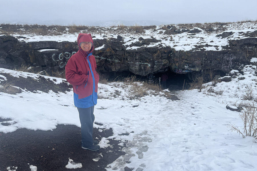
Zosia stands near the entrance to Niter Ice Cave.
Just enough for a couple of drinks! 
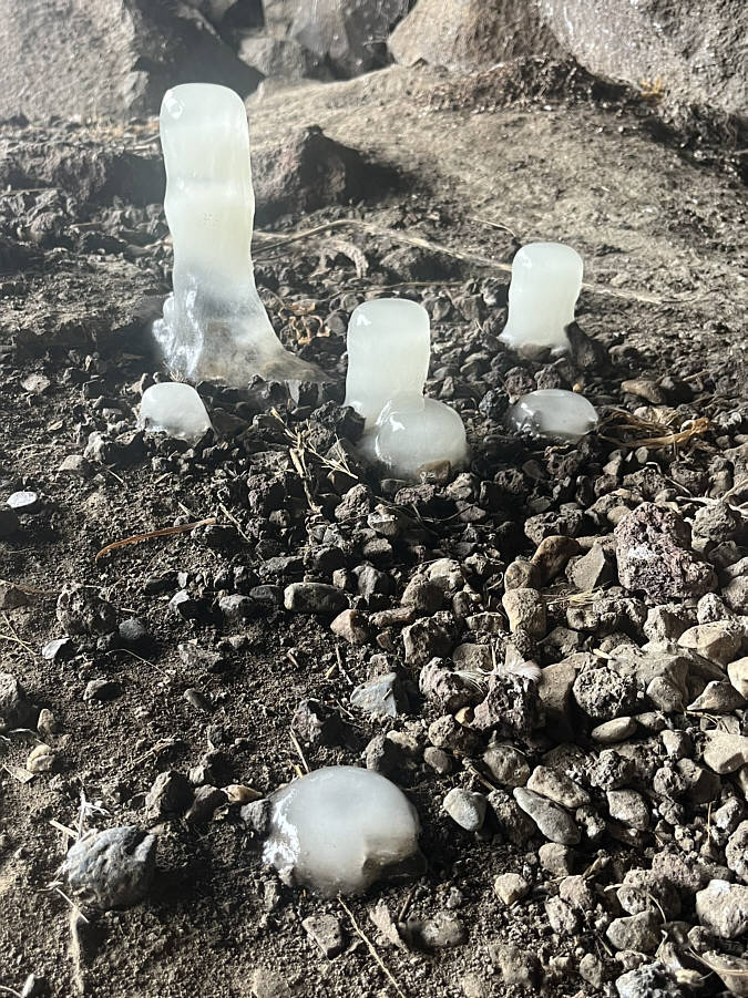
On this day, this is as much ice as there is in the cave--actually right at the entrance.
 

Imagine all the boiling hot lava flowing through here!

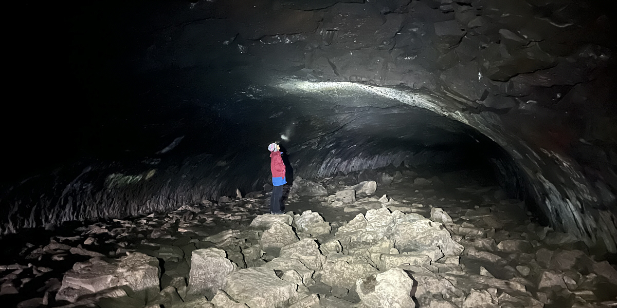
Niter Ice Cave has remarkably smooth walls which almost resemble a subway tunnel.


Made it! 
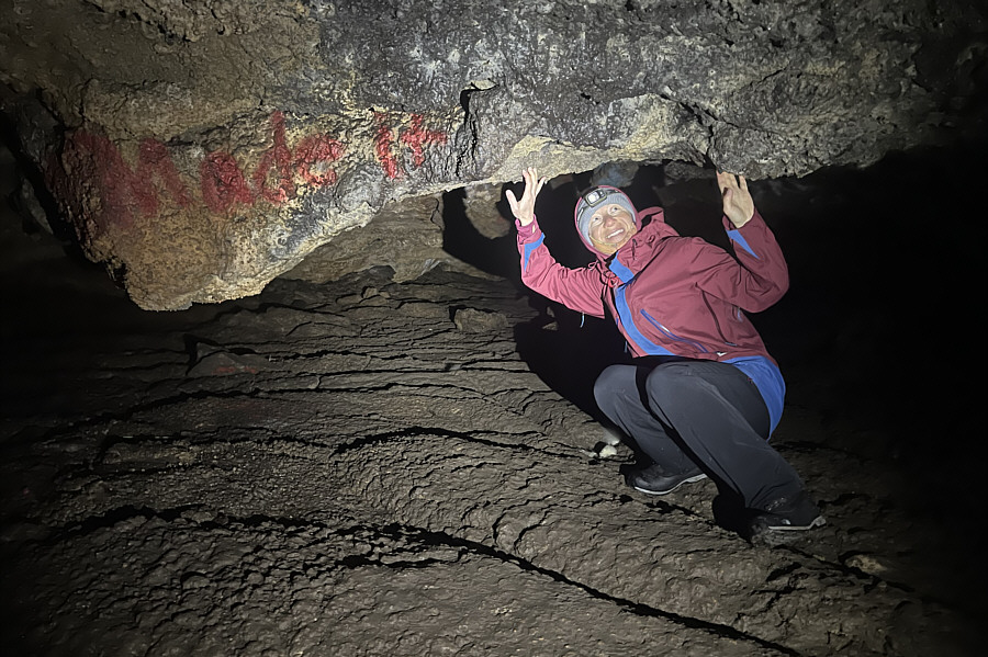
Zosia feels the ceiling of the cave beginning to get uncomfortably low at her turnaround point.